Notes · Sea · Meteo
Swell at La Paloma, September 2026
What happened
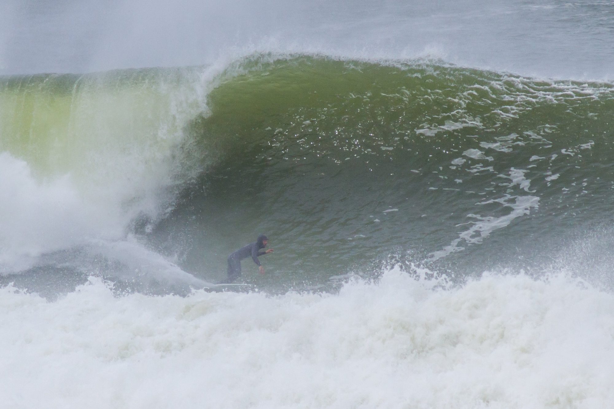
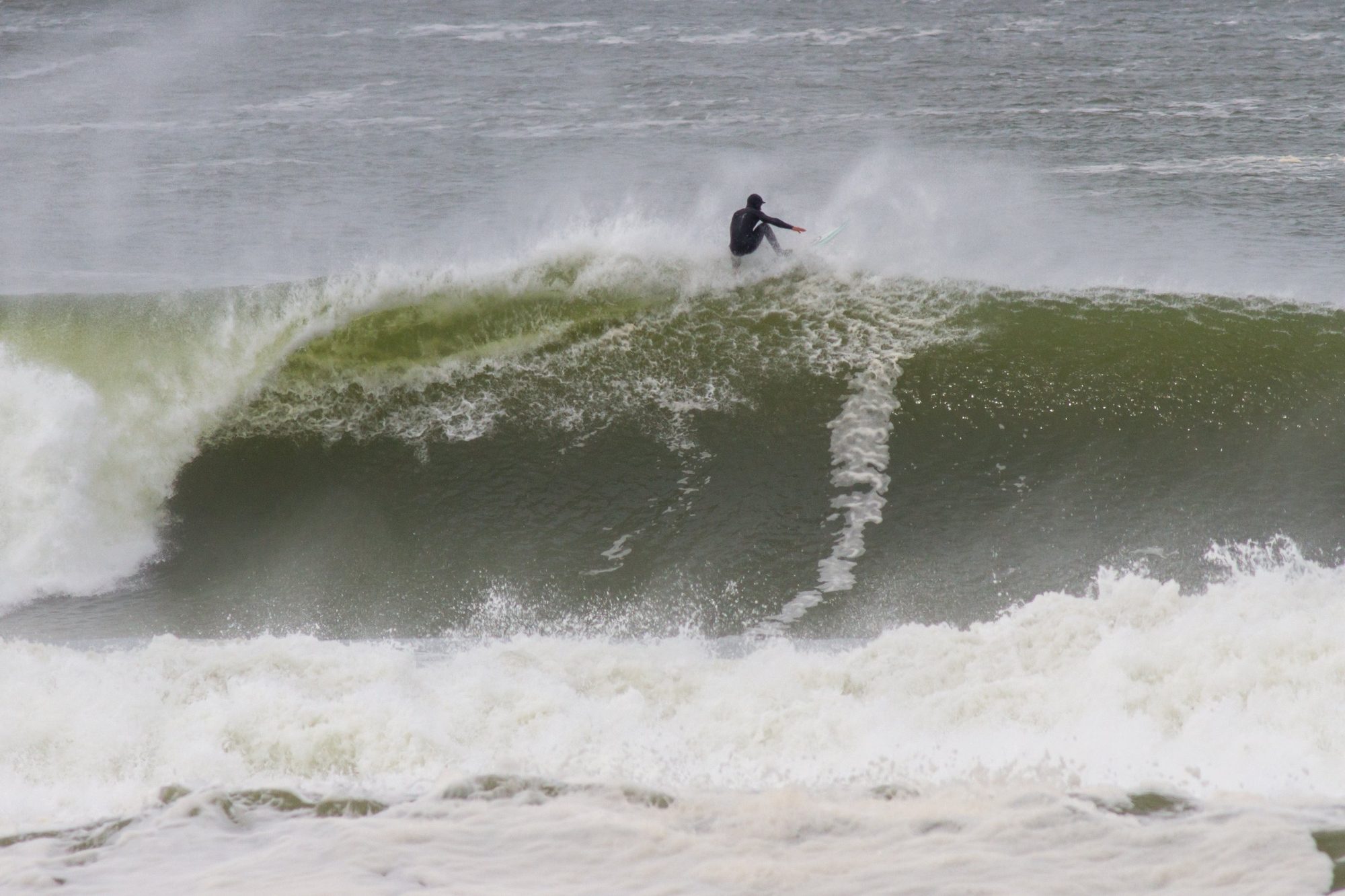
In late September a south swell reached the Uruguayan coast. It built on Tuesday the 22nd and peaked that night, after a day and a half of strong wind, and on Wednesday the 23rd it found what a swell needs to line up: a light offshore wind.
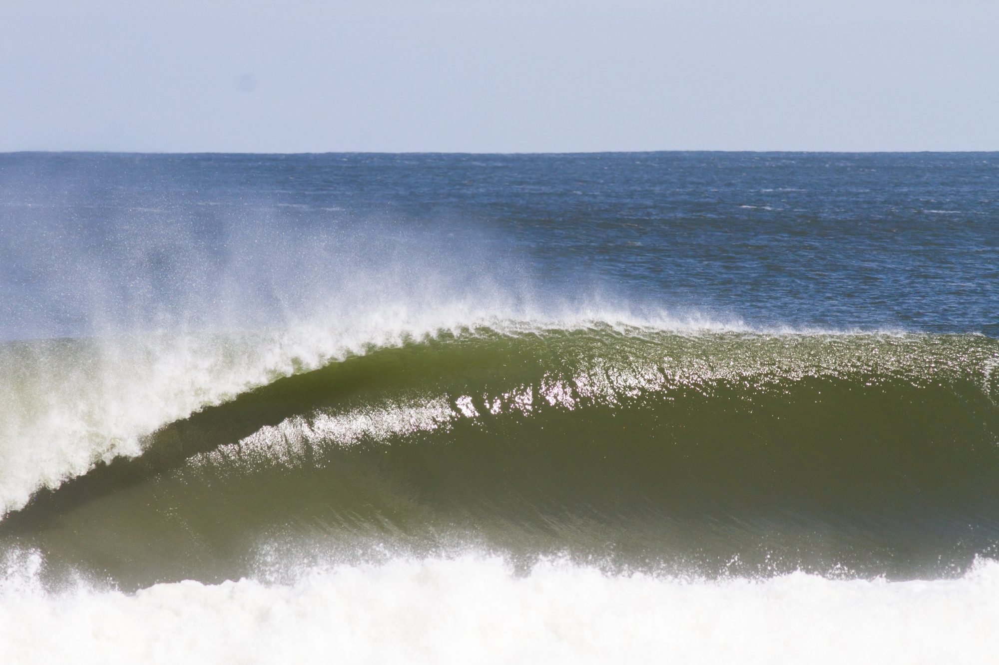
Luis Pereira was in La Paloma with his camera. The first two photos are from Wednesday the 23rd. The third is from one of the following days.
Why it happened
A swell isn't made at the beach. It's made far away, where the wind blows hard for hours over the sea. This one was made more than a thousand kilometres to the south, off Patagonia.
Where it came from
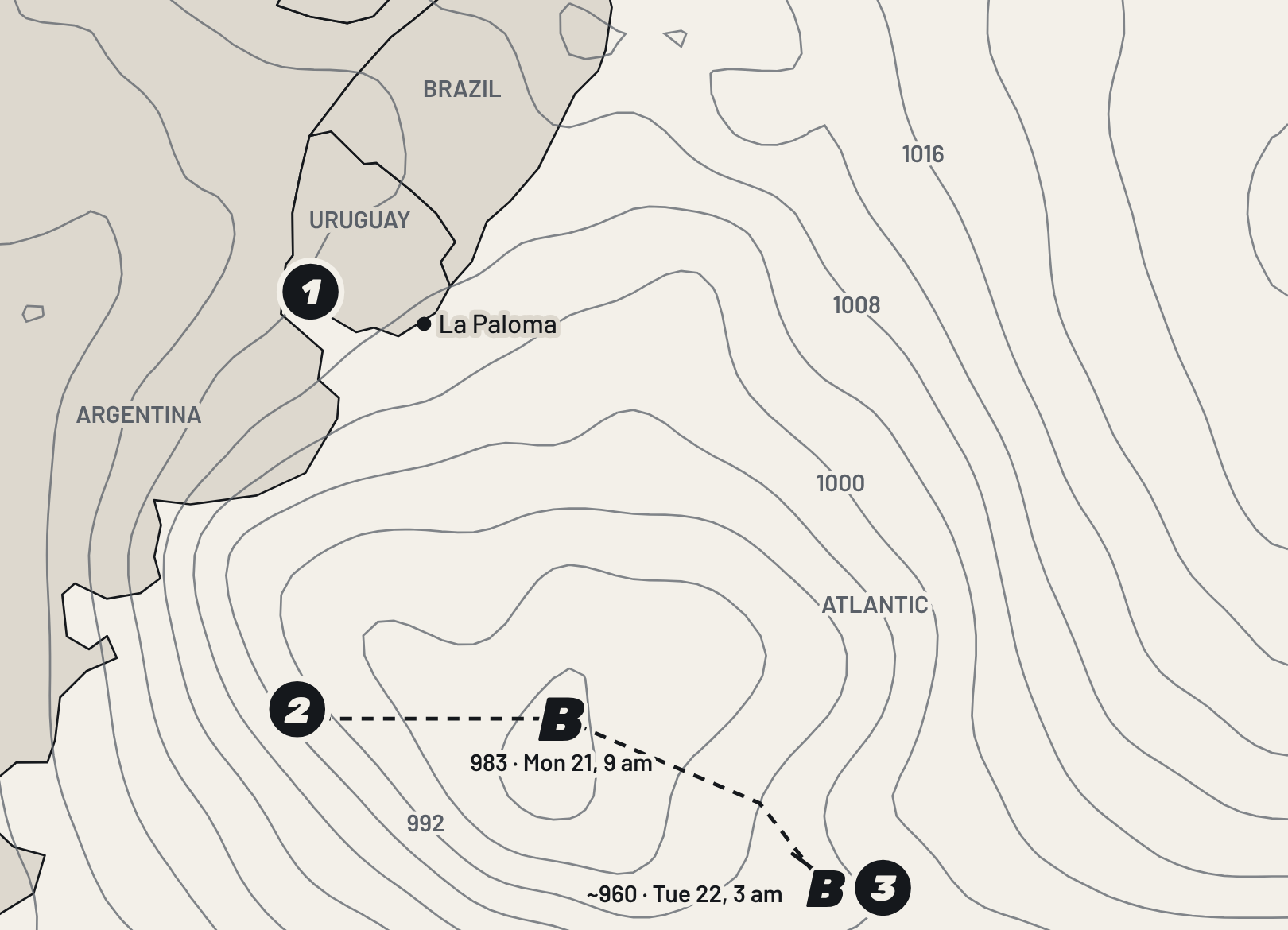
- Sunday the 20th at night and early Monday the 21st: a cold front crosses Uruguay. The thunderstorms come first, on Sunday night.
- Between Sunday the 20th and Monday the 21st: a low moves out to sea off Patagonia and deepens fast.
- Tuesday the 22nd: it moves east and reaches about 960 hPa.
The grey lines are isobars: they join points of equal pressure, every 4 hPa. The closer together they are, the stronger the wind. In the Southern Hemisphere, air turns clockwise around a low, so on its west and southwest side the wind blows from the south.
This low deepened fast: according to the reanalysis, it went from about 988 to about 962 hPa in 24 hours, between early Monday the 21st and early Tuesday the 22nd. On a finer grid, the centre was probably somewhat deeper.
What built the waves
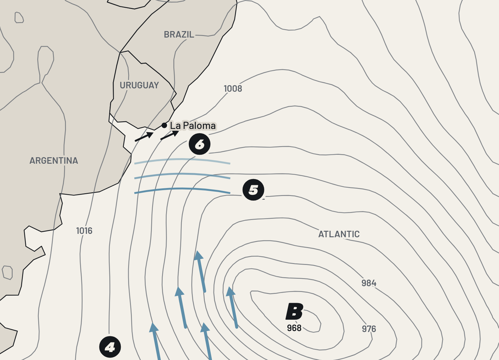
- Monday the 21st and Tuesday the 22nd: southwest of the low, a south wind of 55 to 75 km/h over the sea, off Patagonia.
- That wind builds a south swell that travels toward Uruguay. It grows on Tuesday the 22nd and peaks that night.
- Near the Uruguayan coast the wind blows from the west and southwest, gusting to 80 km/h. On Wednesday the 23rd it turns north and blows lightly offshore.
Off La Paloma, the wave model shows a south swell of about 3 metres at a 10-second period between Tuesday night and early Wednesday. By mid-morning on Wednesday it was still just over 2 metres; in the afternoon it dropped below 2, and by Thursday the 24th it was around 1 metre.
Period is what separates a swell from a choppy sea. On Monday the model also showed about 3 metres off the coast, but short waves, 7 seconds, raised on the spot by the west and southwest wind. The swell that came next had travelled far: longer and cleaner.
On the coast, the wind on Monday and Tuesday blew hard from the west and southwest: gusts of 80 km/h were measured at Punta del Este airport, at Laguna del Sauce, and Inumet, Uruguay's weather service, had a yellow warning for strong winds in Maldonado and part of Rocha, including La Paloma. On Tuesday night the wind dropped, and on Wednesday it turned north. On La Paloma's south-facing beaches, such as La Balconada, a north wind is offshore: it smooths the surface and the waves break cleaner.
The charts are schematic. The isobars and the track come from the ERA5 reanalysis; the waves come from a model, not a buoy, so they give the order of magnitude.
Who
Sources
- Inumet — yellow warning for strong winds (Spanish), September 21, 2026, 11:10
- Inumet — warning update (Spanish), September 21, 2026, 21:00
- METAR reports from Punta del Este airport (SULS), September 20–24, 2026, via Iowa Environmental Mesonet
- ERA5 reanalysis (pressure and wind), via Open-Meteo
- Wave model, via Open-Meteo Marine
- Lineup — the swell at Mar del Plata, day by day (Spanish), September 26, 2026